Written from Louang Prabang, early morning, the fifth of December, 2018
Well, really, I come for the journey, from end to end, the hours on the bike, the whirl of traffic, the long lonely places. . .not the rain I admit, but that hasn't been a problem in Laos, it's been foggy in the morning the past two days, enough to wet the road actually, then blue skies everywhere, followed in late pm (when you'll be glad of a little shade) by puffy white clouds, occasionally casting a shadow where you ride. The temperature seems to run from low 70's early to nearly 100 in the afternoon, quite a swing. At speed on the bike 70 feels chilly in a long sleeved shirt and jeans, but nearly 100 is quite warm, though the helmet and the long sleeves make it fine at speed.
When last I wrote, two days back (it seems longer than that!!) we had spent the night in Pakkading, looking forward to the westward and then northbound leg to Vang Vieng.
Notice that I didn't mention Vientiane, the capital, which sits just past midway between the two. I've visited there once in the past and liked it perfectly well. . .as far as cities go. As a capital city it must be one of the most relaxed on earth. I mean, when, for example, I turned down a one way street and began proceeding the wrong way, a policeman stepped out of nowhere, smiled and gestured at me to turn around. . .pointing at the one-way sign I'd just come to. No hassle, no problem, just please go the right way. Compare and contrast that with wherever you like! But this trip I've decided to bypass it again (I tried once before) and so set my navigation system (Maps.Me) directly on to Vang Vieng. This a little like trying to go from Tacoma to Everett without passing through Seattle. No doubt it can be done, but don't expect it to be straightforward! The new handlebar mount for the cell phone kept it in plain view, the blue ribbon of calculated route unwinding flawlessly through the suburbs and then offered to shunt me off onto a dirt road. I don't mean an arterial under repairs, I mean a dirt road. That's what happened with paper maps last time. . .more or less. . .and I wasn't having anything to do with it. The road to Vang Vieng had been clearly indicated in the overhead signage. I switched off the phone and carried on. It worked.
But oh my goodness, Highway 13N (we'd just finished 13S) is in dreadful shape, as it turns out, all the way to the outskirts of Louang Prabang. Mind you, it was in dreadful shape for the past 400 km more or less, or so I thought. As we proceeded on to the north I revised my definition of "dreadful" down several notches. There's a lot going on I think, for one thing, a massive Chinese project to build a high speed rail link between Vientiane and Louang Prabang, more or less along the alignment of the existing Hwy 13. You only now and then spot the early work, bridges and overhead structures just getting out of the ground, some massive earthworks already well advanced, and reportedly a number of tunnels and a major bridge over the Mekong already underway. And all the trucks to support that have hammered the highway, all along its length, to the point of destruction. Maintenance has given up it seems. When the road is sufficiently hammered, they simply dig it up down to the subgrade, roll in a top lift of new crushed rock (some of it uncomfortably large), mix it with some clay usually, and compact it into the gap. Seriously, miserable as that is it's still much better than leaving big isolated chuck holes, or stretches where the pavement has become a minority of the roadway. . .like mesas in the southwest desert, the islands of asphalt reach out to smash your wheels or overturn your bike. Why better you ask? The patch may be rough and treacherous under foot, but it can be (and generally is) able to be re-graded and re-compacted now and then, so it remains more or less passable. It's interesting, mostly the local pickup trucks (Toyota's mostly) slow down very little, if that, but all the heavy transport, trucks and buses, and all the motorbikes slow way down. . .the bigger the truck and heavier its load the more nearly it stops at each break in the pavement. You may run on a kilometer, or only a couple hundred meters between the breaks, sometimes enough to get clear back up to speed. . .and then come to a screeching halt behind a freighter coming to a full stop to edge into the mess. Over and over and over.
This is not the sort of riding that makes for lots of stops for photos. If you've just risked life and limb to get around a massive tank truck moving just above a walking pace. . .you don't feel like stopping to take a photo of a pretty house or some cute kids, even if they're there! So the last two days, moving north from a point about 60 km south of the day's destination at Vang Vieng (tourist capital of Laos) all the way to Louang Prabang, have been difficult hard riding, completely absorbing, but also often filled with wonderful beauty and fascinating human activity, people living and working on near vertical ground immediately adjacent to the through-road. But there are few photos to show you. Here they are:
 |
| Actually, this is the early morning in Pakkading before we got under way, our landlady out back picking greens and leaves and pitching the occasional weed. |
 |
| The front door of the restaurant across the street from the GH in Pakkading, but they weren't open in time for our departure. |
 |
| Looking down into the harbor just before leaving, better lighting The boats aren't any prettier! |
 |
| Thailand on the other side. |
 |
| Mobile watermelon shop, and the melons were moving briskly, she sold three while I maneuvered for this. The umbrella folds down for travel on the highway but around town in the heat of the day. . .marvelous! |
 |
| The little horse, still pretty clean, leaving Pakkading. |
 |
| Lunch stop north of Pakkading, quite hot out! The pitcher of water and bean sprouts is to make fatter bean sprouts, not some sort of veggie tea. Ice water under the blue lid. The shy proprietor suddenly pulled out a phone and asked to take a selfie with me. Guys with bushy beards seem to attract that sort of thing here. |
 |
| Why you should always at least glance at the photos on the wall. . .a 1926 photo of the airmail plane arriving at Luang Prabang (thus on the Mekong, with substantial current, and hence the mooring crew). If that gang can't hold her they could just eat her! |
 |
| Sixty km short of our destination (Vang Vieng) sun just at the horizon, and there's one hotel in town. I only need one, and they had a room on the ground floor (just as well, I'm sure I'd not have gotten my big bag up their stairwell. . .I made it on foot, but it is as steep as a ship's ladder and a lot taller. Kind of funky room, tiny, with an unpredictable hot shower (scalding shower more like), but lovely people, Mom running the placer with help from at least four grown kids and their wives/husbands and Dad, and a few grand kids. All very sweet and helpful. Tired out, I went to bed before 9:00, and (??) they woke me up at 10:30, shutting the place for the night and wanted me to lock the bike! Then Mom put a table cloth over her. . .to keep her warm?? |
 |
| A village at a junction 60 km south of Vang Vieng. . .that's about half of the town, |
 |
| Just a couple of houses on the highwayt |
 |
| And now we're among the mountains, though the road stays in bottom land a lot. |
 |
| But we get up actually into the hills, and later (albeit in horrible road conditions) onto the ridges as well. |
 |
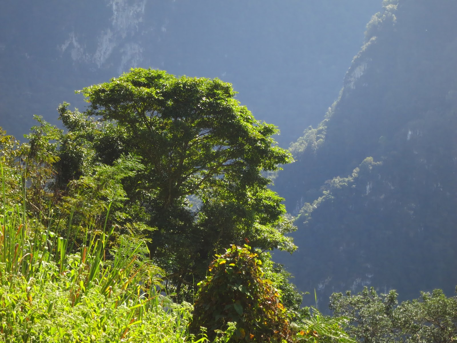
| When it's good, it's very very good. When it's bad. . .you don't stop for a photo! |
 |
| When I'm not here, I wish I were. When I am here I wish they'd fix the darned road. |
 |
| Perfect riding, sometimes for up to a km at a time. |
 |
| The two yellow tankers. . .climbing the mountain at a walking pace, who'd think they had such a low gear?? You could jog past them, but they take up almost the whole road so passing with the bike took calm nerves and care. |
 |
| The restaurant on top of the world. . .perhaps the highest highway summit in the country? I've heard there's another that's even higher,. I was here the day they poured the driveway at the top, to the restaurant. They used bamboo (split pieces 2" x 1/2", cut to length) for reinforcing bar. Look at the upper part. . .no cracking at all. |
 |
| The best day I've ever seen here, visibility many miles and bright lighting. Last time I saw it was in a mizzling rain and fog, with visibility in the hundreds of feet! From here it's mostly downhill to Luang Prabang at the Mekong's banks. Still a lot of climbs, Hwy 13 goes up and down a lot, but the trend is downhill and the bike hums along, dodging chuck holes and tiptoeing over bigger repairs (?) in the roadway. I was here in time for a late lunch if I'd been hungry, but carried on after a coffee and the photos and made LP in four hours more. That's terrible time, but reflects the horrific condition of the highway. If you're considering a trip through these parts, a bus might be a better idea than a motor bike until they do something about the road. On the other hand, I saw several broken down buses along the way. You pays yer money and takes yer chances I guess. But it was a really hard day's travel. |
 |
| Stop the presses! Step back five days, my good friends in Hue made a fuss about sending me off in the rain and insisted on one last photo (we already had done one with me and each of them and one with all of us together, so this was all that was left, me in rain coat, plastic boots, rain pants and the Rain Cape. Now you've seen it all. We made Lao Bao and the rain stopped, it's been lovely ever since. But now you've seen my cape and its front window and its neat (but leaky) holes for the mirrors. That's the last of the rain cape nonsense I promise! |


No comments:
Post a Comment